Old Favorites Repeated: Ptarmigan Tunnel and the Highline Trail

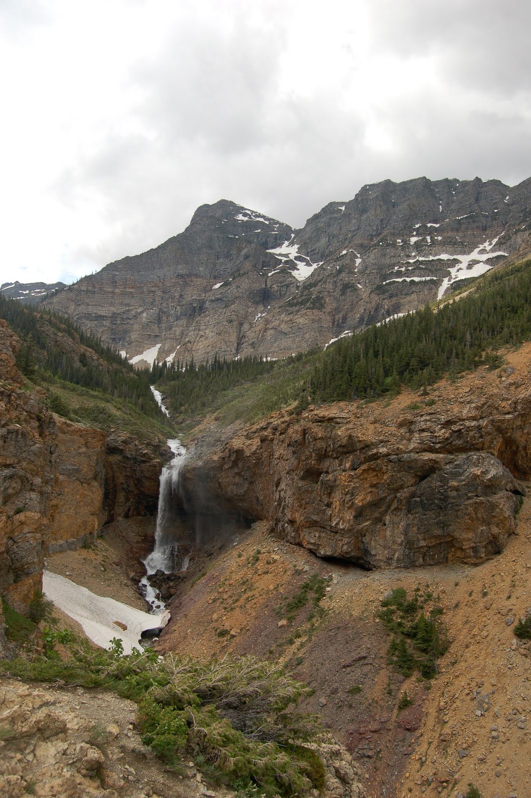
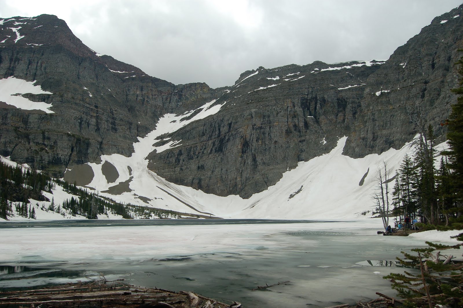
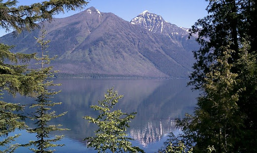
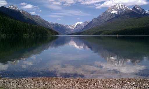
This week we decided to hike two hikes that were favorites from when we were here two years ago. First, we did the Ptarmigan Tunnel trail. Glen had hiked it with Kyle last time, but it was new for Terry. The photo above is Ptarmigan Lake where we stopped to rest and enjoy some Clif bars before continuing to climb up to the tunnel.
Just past the lake we saw the biggest marmot we have ever seen. Glen says it was the “king” marmot! He was the size of a small beagle. (Watch out, Rosebud!)

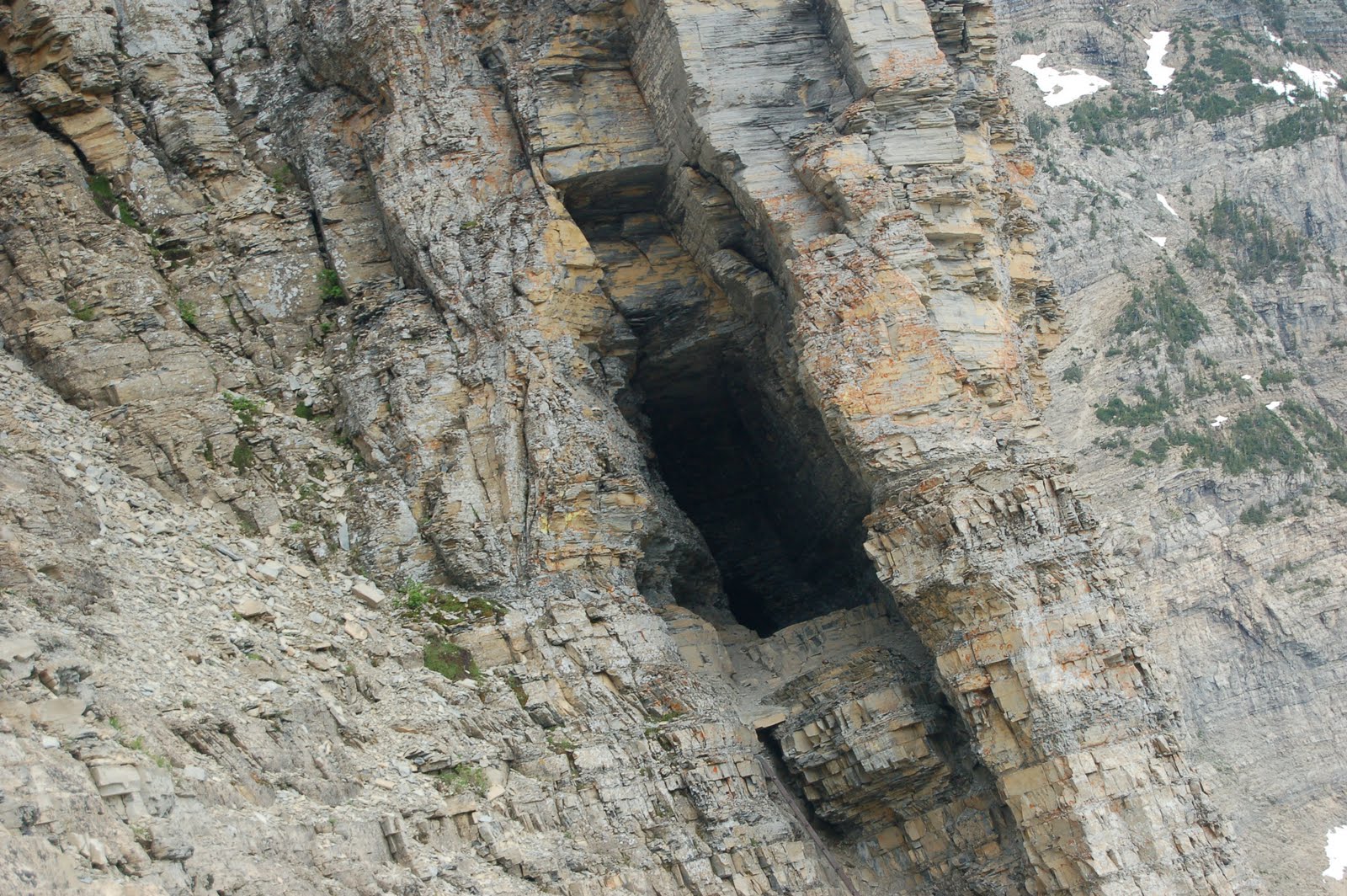
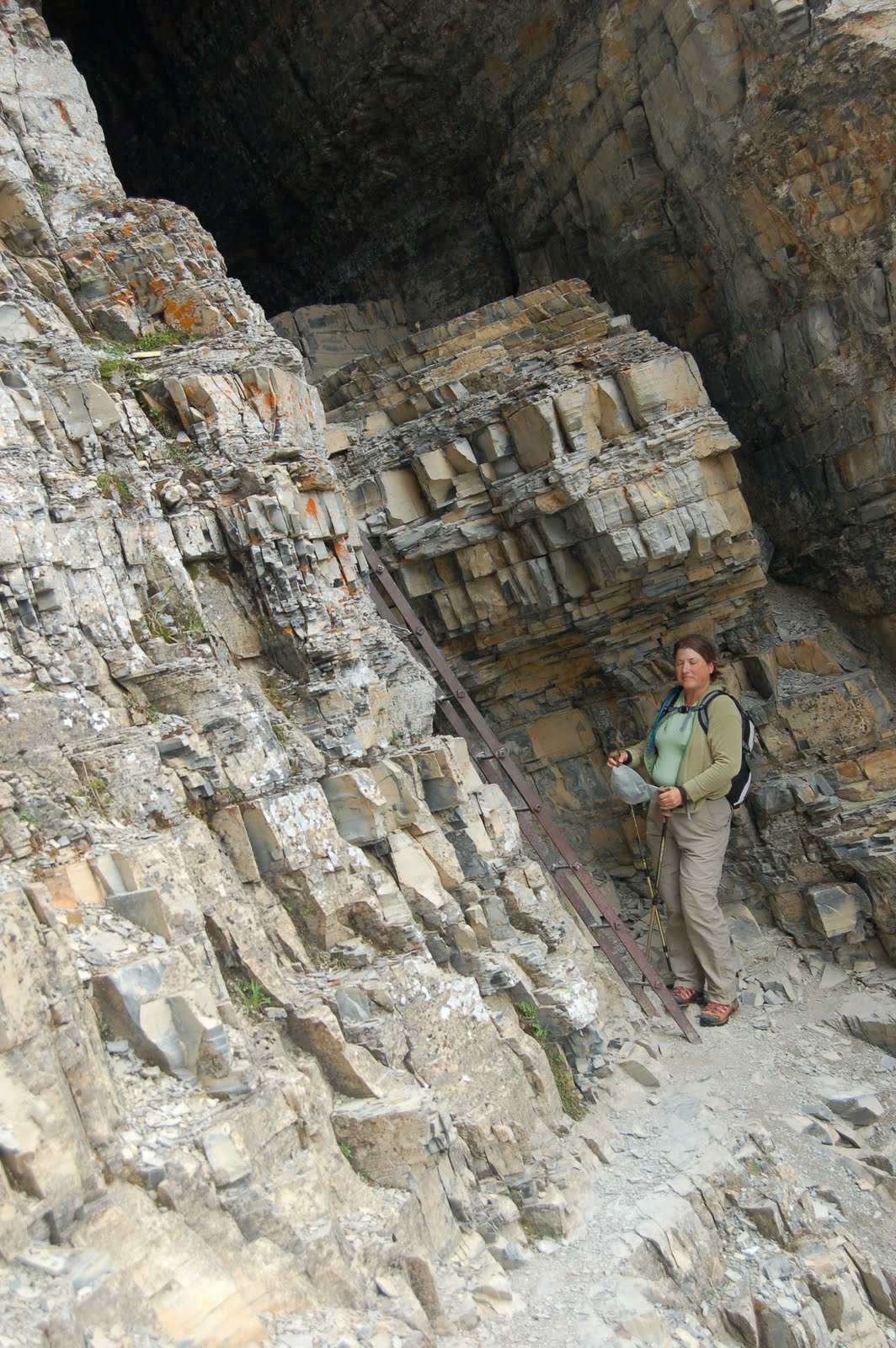
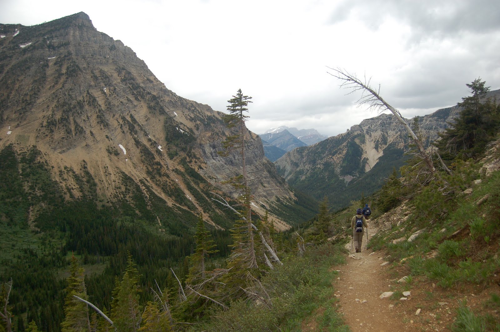
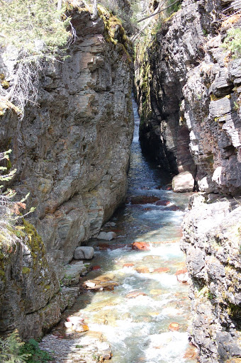
Above, you can see Terry going through the tunnel. It was carved out here and was used by people and horses in the early days in the park. It still can be be accessed by horses, and we actually saw one girl on her horse on the trail the day we hiked it. There are big metal doors to close off the tunnel in the winter. Unlike most tunnels where cars or trains go through near the bottom of the mountain, this tunnel is near the top.

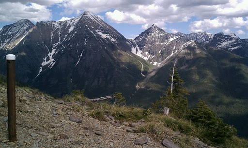
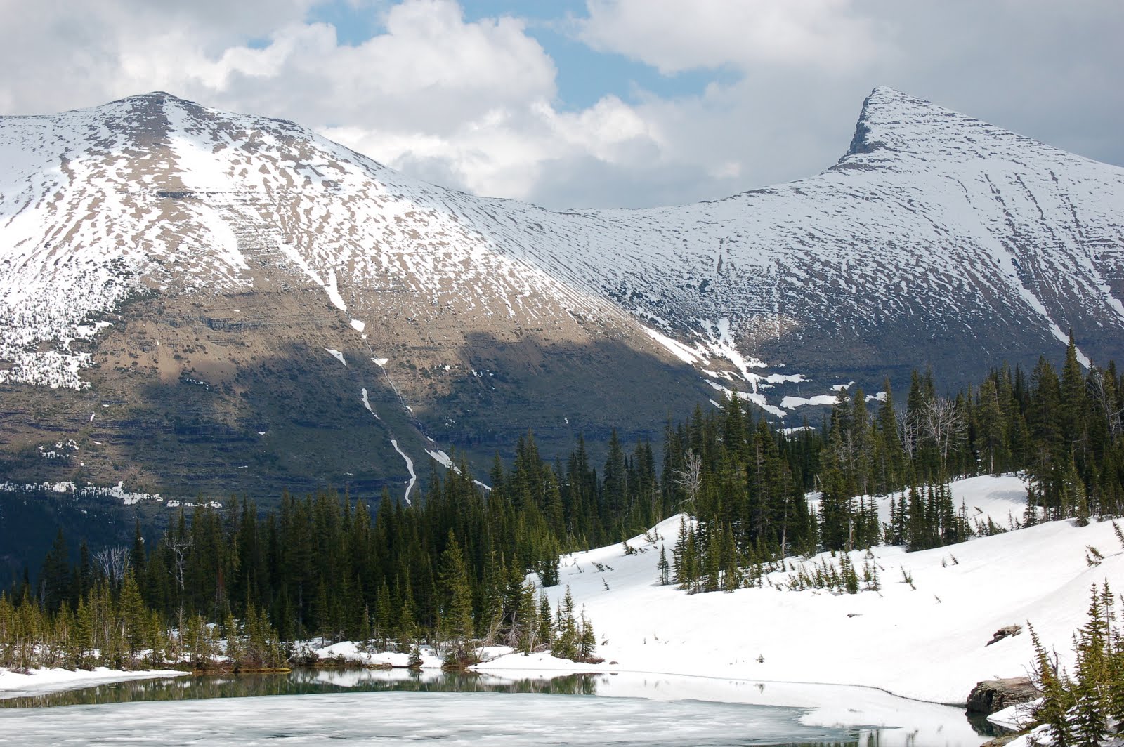
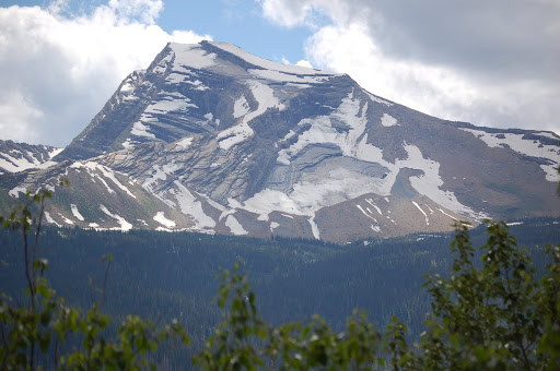
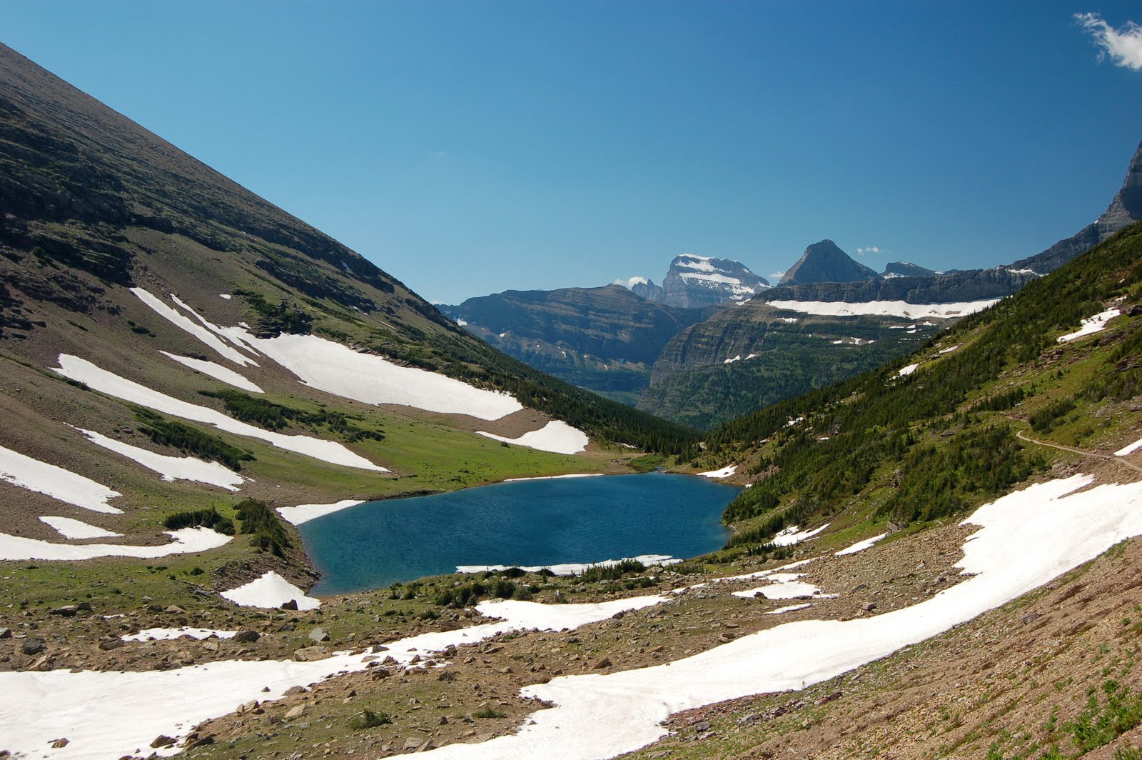
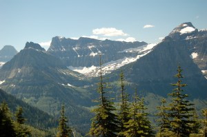
Here is the view you see when you go through the tunnel. It is a valley and lakes that of course is hidden the entire time you are climbing the other side of the mountain.
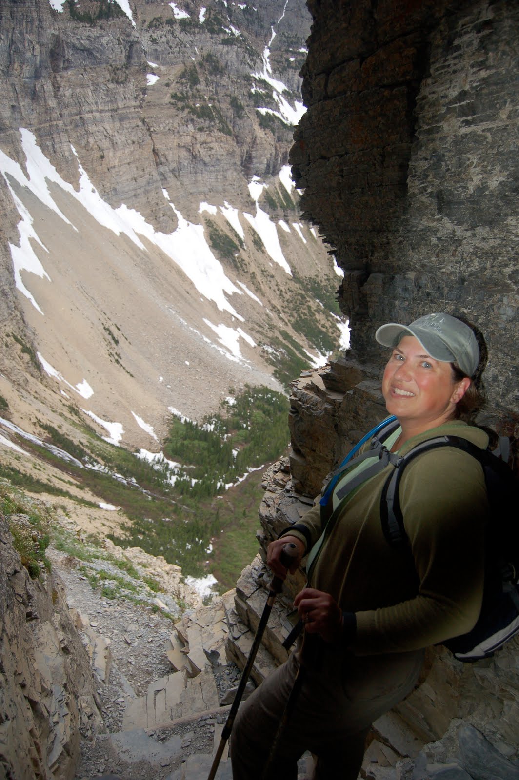
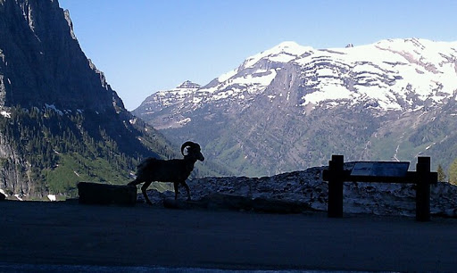
Glen is posing in front of the great view. We stayed for a few minutes and admired the view, saw the local marmot, and then went back through the tunnel to head down. We saw a bighorn sheep on our way down.
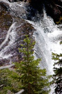
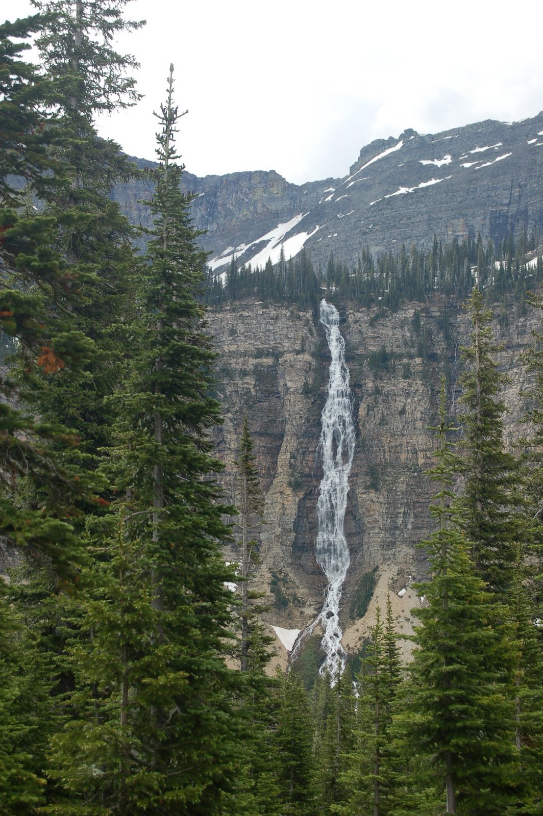
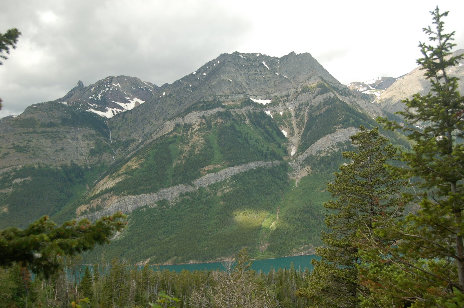
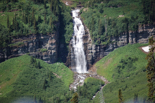
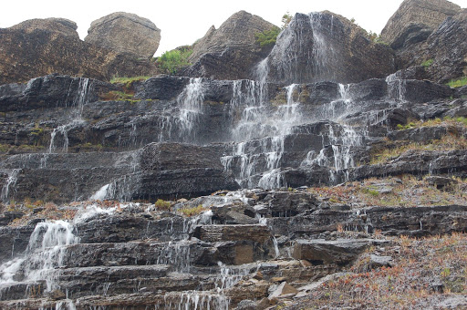
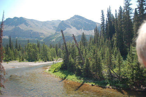
There were several beautiful waterfalls on the hike. In fact, there were many photographic opportunities. We saw one couple with big backpacks and asked where they were camping overnight. It turns out that the packs were full of photography equipment! We decided they were tough cookies!! Can’t even imagine hauling all that to the top of mountains.
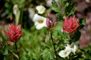
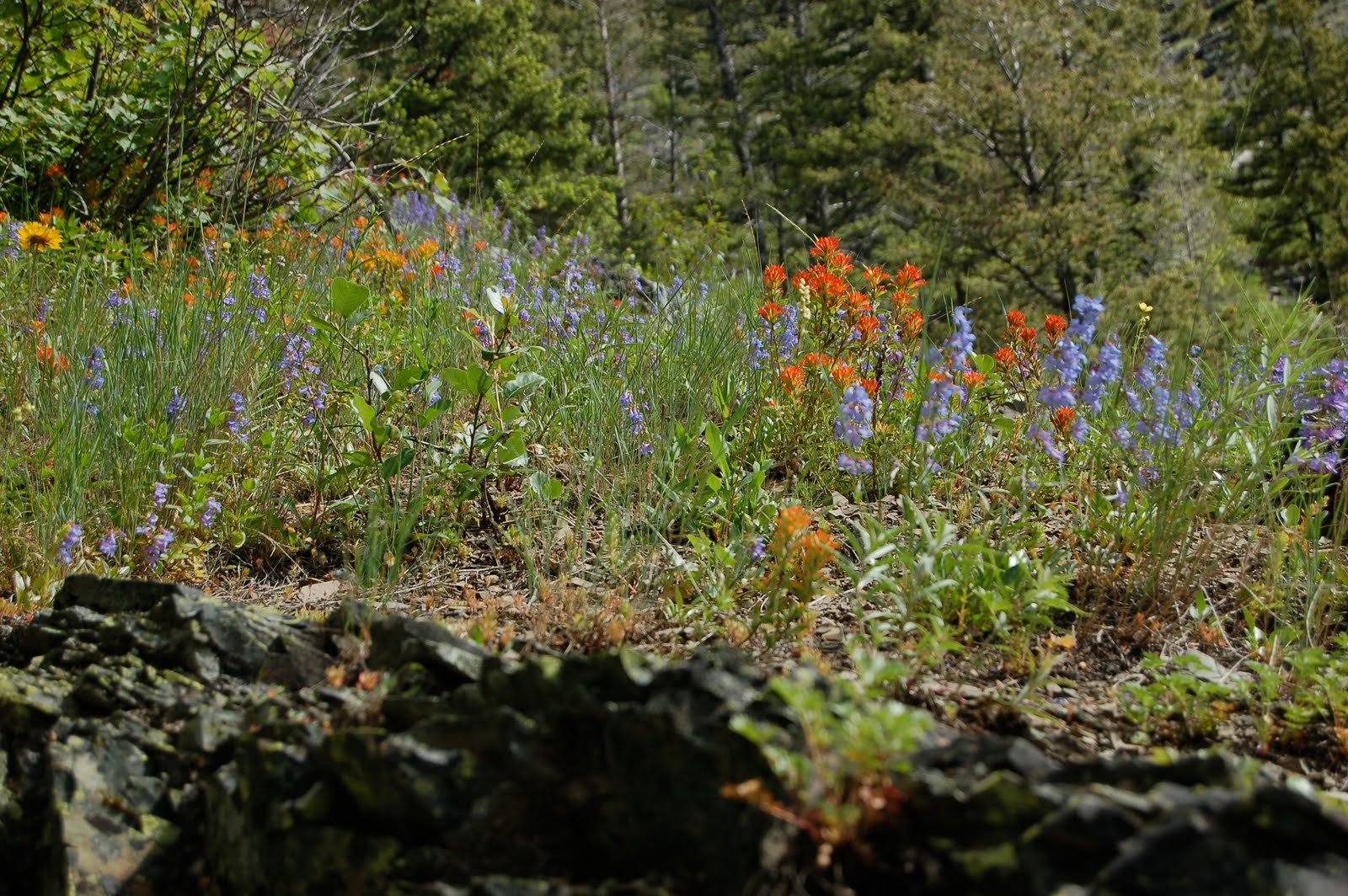
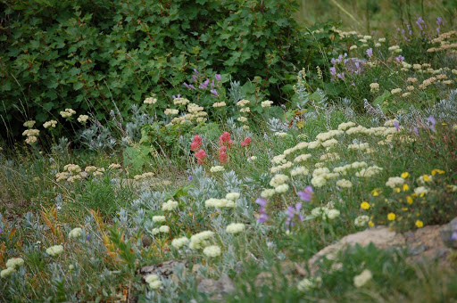
The wildflowers are still in bloom, and the devils’ paintbrush are coming out. We like this rose colored version of that.
When we got back to the trailhead, we were greeted with a note on our car. It was actually the second time we have had this happen this summer. This one was from a couple from Aroostook County. They saw our license plates and put a note telling us their campsite number and that if we were around in the evening, they would be back and would love to visit. Previously, in Banff, we had a note on our car that just said, “Go, Black Bears!!” We did try to look that couple up, but they were not in their campsite when we went by. Small world!
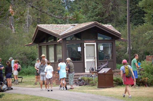
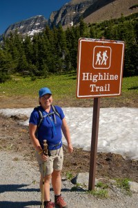
After a rest day, we were ready to tackle the Highline Trail. This was one we did before on a cloudy, misty day. This time we were treated to brilliant sunshine, and it was a beautiful hike.
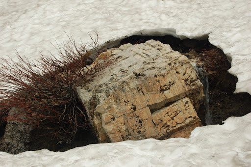
When we arrived this summer, the trail sign was just barely sticking out of the snow. You can see that isn’t the case now, but there are still traces around.
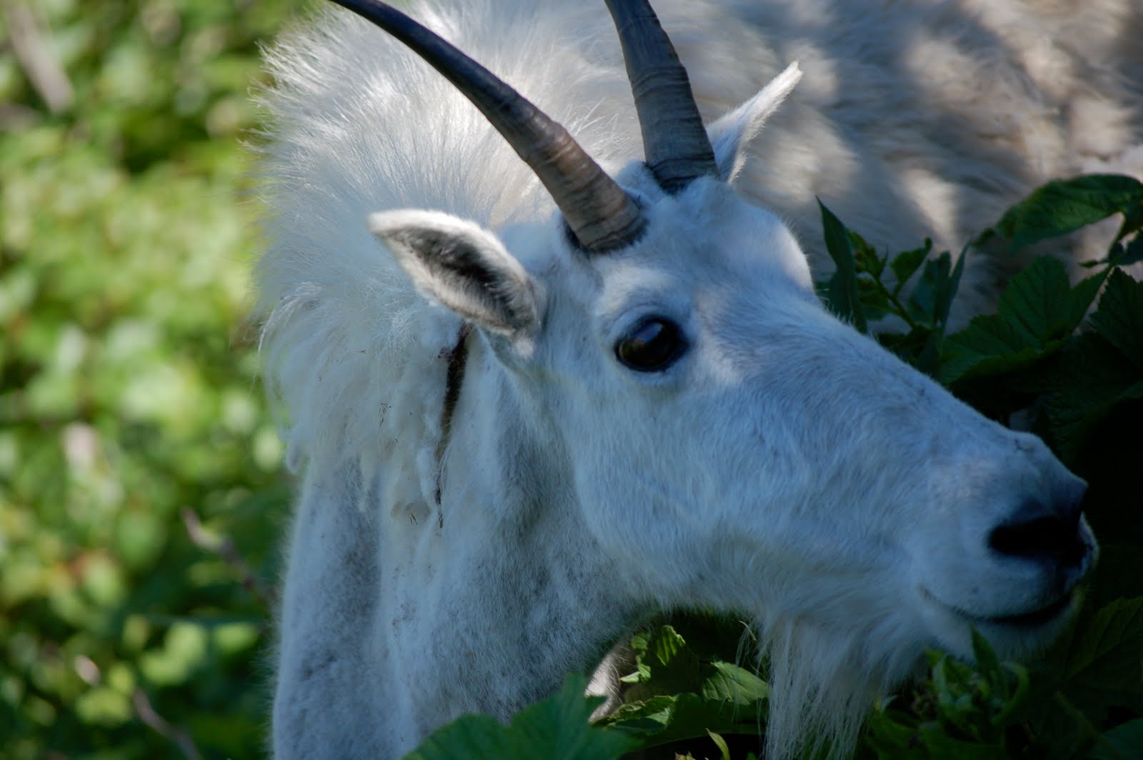
Mountain goats love this trail, and once again we were treated to many sightings. This one tried to chase Glen a bit, but mostly just wanted to eat!
Views were crystal clear that day and we decided to take lots of photos.
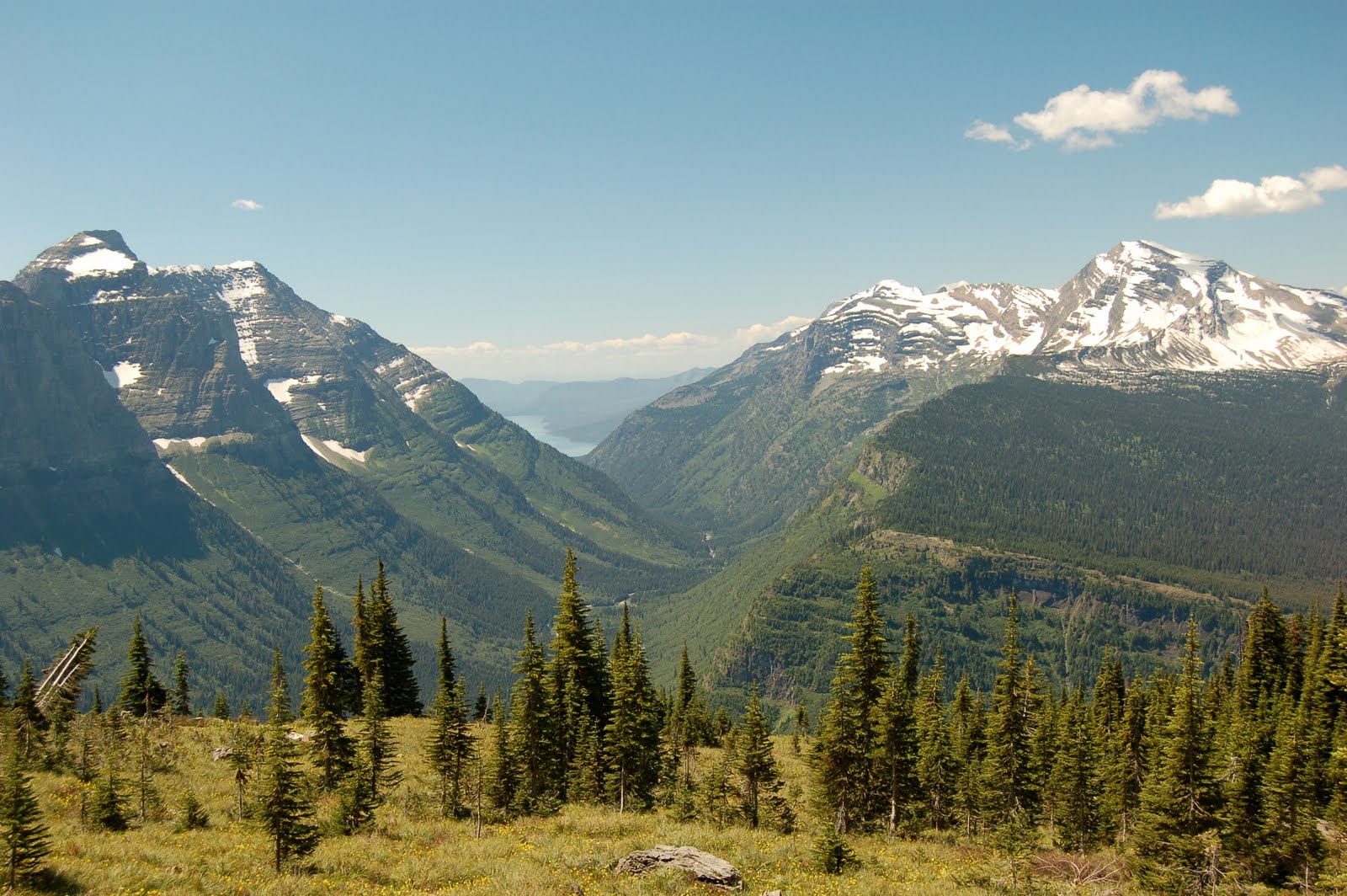
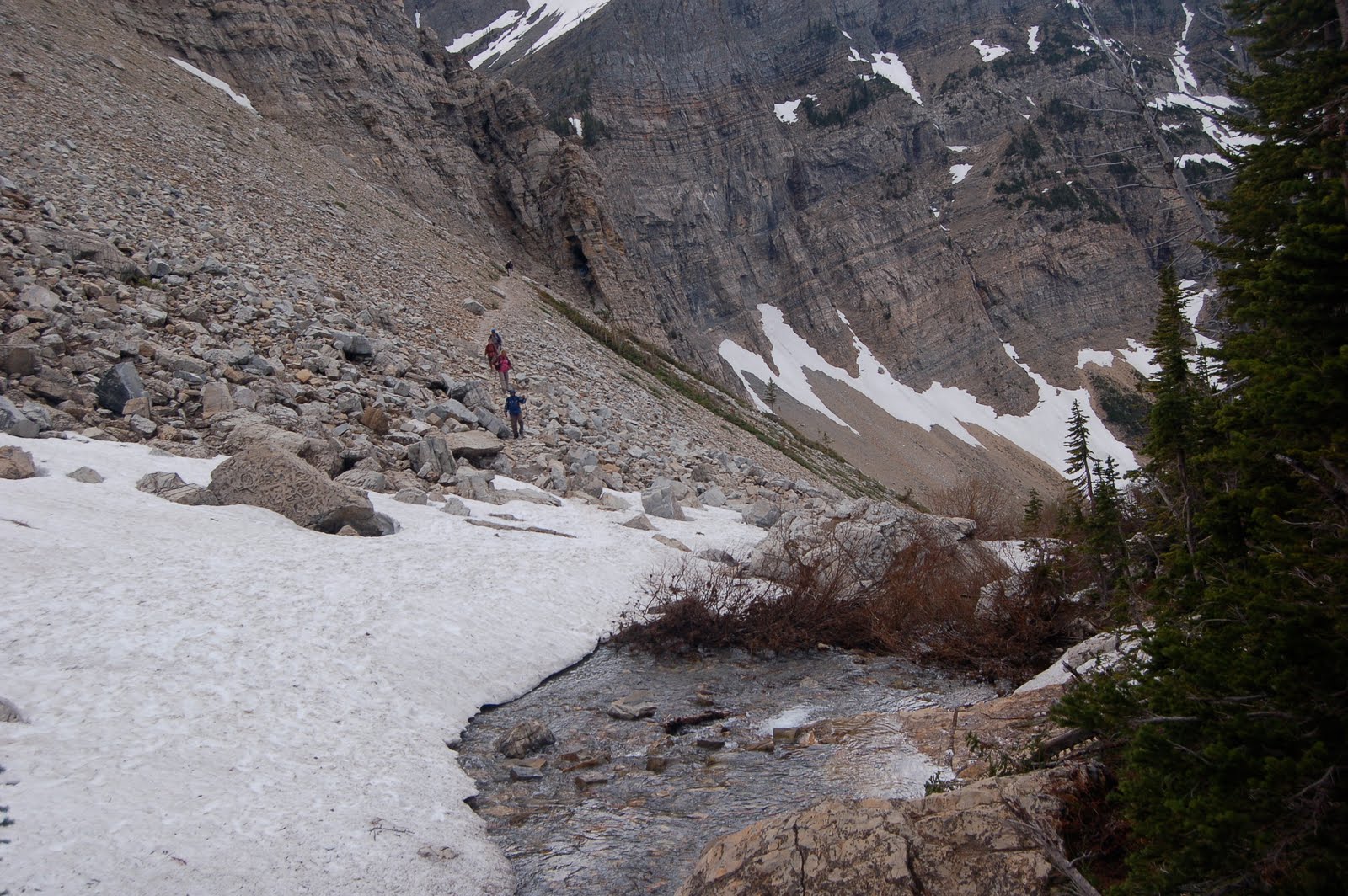
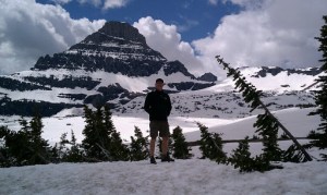
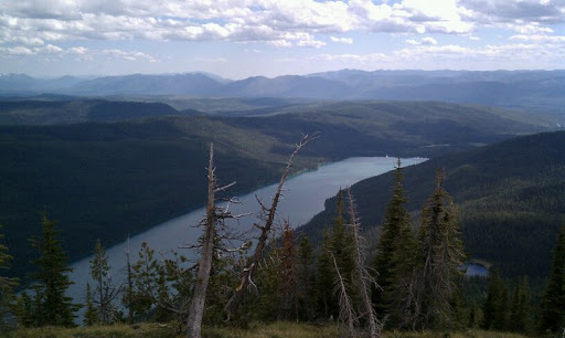
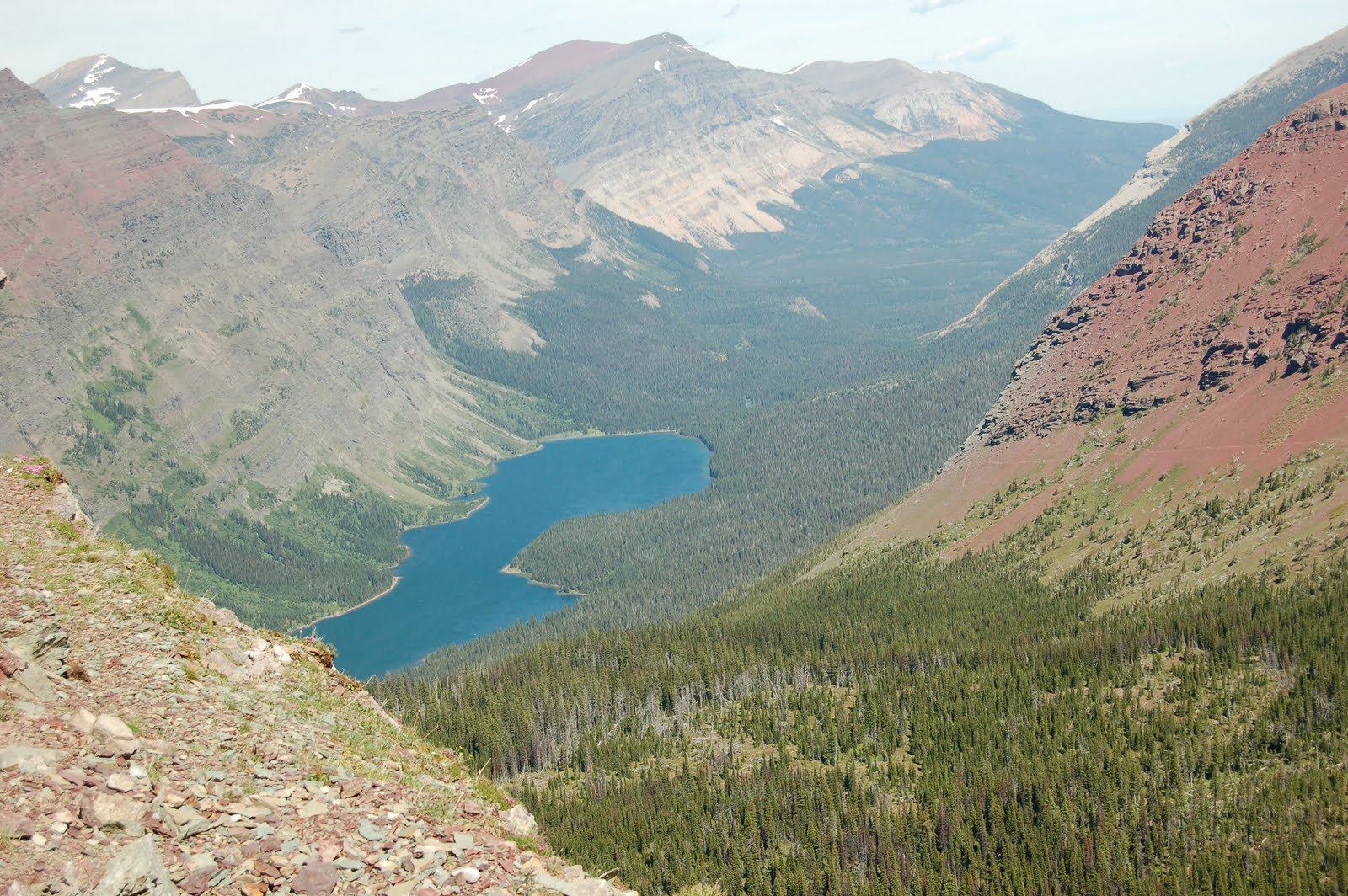
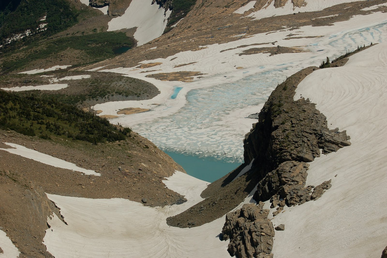
We also decided to take a side trail to Grinnell Glacier Overlook. It climbs 1000 feet in 8 tenths of a mile. (Steep!) Partway up, Terry was questioning the wisdom and wondering if the payoff was worth it. Answer….yep!
Above, you can see the view we earned as we look down on the lake that the glacier is melting into.

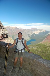
Glen once again showing the scale of the view. Then, we descended back down to the Highline Trail and hiked to the Granite Park Chalet. This was our lunch spot.

After the chalet, we hiked downhill to the Loop. This is a location on the Going to the Sun Road where we had left our car that morning. It was an interesting ending as we hiked down with a gentleman from Massachusetts, and we talked all the way.
This ending was different for us, as two years ago we had taken another trail after the chalet.
So, while the two trails this week were somewhat repeats, each had something new about them and we enjoyed them immensely.
Until next time,
Terry and Glen

Banff, Lake Louise, Icefields Parkway, Columbia Icefield

Banff National Park in Alberta, Canada. This was the setting for a four-day mini-vacation. The photo above is from Lake Louise, and we’ll give you more details about that area below. We didn’t have to earn this particular shot — even the tourists in flip flops or Guicci loafers were treated to this view — but that just made some of the other views taste even better.
We drove north, through Calgary, and then west to Banff. Getting through Calgary was a bit more complicated than we expected. (Stupid Walmart Atlas!!!) As the driver, I am willing to admit that it WAS the map, not the navigator that made Calgary a fun time. It was time for the Calgary Stampede, and we ended up driving right through the excitement. An hour later, we did make it through Calgary and were on our way. We snagged a campsite in Tunnel Mountain Campground and then proceeded to explore the town.
The city/town of Banff itself, is like Bar Harbor on steroids. Picture shops, restaurants, and a bazillion tourists, but instead of being located on the ocean it is surrounded by mountains. The first challenge was to find a place to park, and once that was accomplished, we had to choose between dozens of places to eat. Yeah, life’s tough. After dinner in a local restaurant, we tried to get back to the campground. It seems that between the time we got our site, and the time we tried to return, everyone from Calgary had finished the work week and wanted to camp in Banff. There was a long line trying to check in to the campground. It would take people over an hour to get from the road into the gatehouse. When we finally got back to our site, we had a good view of the line, and it never ended until they closed the gate at 11:00 pm. I guess we won’t complain any longer when we have a few customers in our KOA lobby.
One cool thing about Canada’s national parks is that when you sign up for a campsite, they ask you if you want a fire ring. If you say yes, you pay a fee/day. Then, they have this gigantic pile of firewood that you go to and take what you want. So, instead of trying to find a local selling small bundles of wood for exorbitant amount of money, you can really make a fire. We enjoyed this perk all three nights we stayed there.
We were up and away early to go to the Lake Louise area of the park. We wanted to do a hike to “The Plain of Six Glaciers”. It starts out around the shore of Lake Louise, and then climbs up to an old tea-house built in the 1920’s. (I think-anyway it IS old) All along the way you have incredible views of glaciers ahead of you. It’s easy to see why this area has so many visitors, when views like this are accessible to everyone.
We did have to cross a few wet spots. This is where I was wishing I had my waterproof hikers on. I chose to wear just my trail sneakers….and it worked out fine. My rock balancing skills paid off! The camera man was ready just in case of a spill, but things went smoothly.
Above you see some of the glaciers and we actually heard this one break off. It sounded like thunder and echoed off the surrounding mountains. It looked like waterfalls coming off the glacier, but it was really snow. It happened twice while we were on this hike. Now we come to the views that we had to earn, and for some strange reason those pictures always seem to be more beautiful.

This is the view looking back when we had climbed awhile. We started the hike at the chateau you can see at the far end of the lake.

This is after one of the pieces broke off the glacier. You can see the snow falling down like a waterfall. The first time that this happened, we actually thought that we were looking at a waterfall. It wasn’t until the snow stopped falling that we realized what must have happened.

This is at the tea house. We had scones with strawberry jam and tea and lemonade. Wish all hikes had a tea house at the top of the climb! It’s amazing how good dry scones and tea can taste — nothing like a hike to whet the appetite.
This big boy was waiting for us the following morning as we decided to drive the Bow Valley Parkway on the way to the Icefields Parkway. We had decided to spend the day on a scenic drive and visiting the Columbia Icefields visitor center.

This is a view of the meltwater and the blue ice on the glacier. The dirt is because glaciers are made from compressed snow. Snow forms around a center of dust or dirt, so when it melts the dirt is left behind.

This is Glen standing on the glacier. It was pretty cold and slippery. We aren’t ready to try ice climbing any time soon! It felt like we were standing on a few feet of snow and ice, but the glacier was actually 1000 feet thick at this point.

This big ice bus took us a mile out onto the glacier. It is an amazing machine, but we don’t want to buy one. Each one costs a million and a half!! And each tire is $6200.

This is looking from the ice bus to the side on the return journey. You can see the side moraine and above it, is another glacier. I think it was called Double A glacier as the mountains on each side both began with the letter A.

Crypt Lake Hike

July 4th, 2010 was spent mainly in Canada. We woke early and drove to the Chief Mountain border crossing. Since it opens at 7:00 am and we were there at 6:50, we were first in line to cross. Traveling on to Waterton Lakes National Park (The Canadian partner to Glacier) we arrived at the boat dock to purchase tickets, round up a cup of coffee, and get gear ready for the hike.


We took a short boat ride on Waterton Lake to get to the trailhead for the hike to Crypt Lake. We got started a bit late as there was a couple that just had to try to buy tickets at about two minutes to 9:00, and then had to go back to their car to get gear. There always seems to be someone that thinks the world will wait for them!


This hike has been called “Canada’s #1 rated dayhike” so we thought it was worth a try. On the way the ranger was informing people about the trail, and thought it would be quite funny to tell people the trail was only 2 and 1/2 to 3 inches wide at one point. (Then he clued them in that it was really 2 and 1/2 to 3 feet)


We were hoping for a good weather hike, and overall it was okay. It was really windy, and we did get sprinkled on, but the rain held off for us. You have to choose a return boat time when you sign up for the hike. There are two boats that drop hikers off in the morning, and two return boats in the afternoon. We opted for the first morning boat and the last afternoon boat in order to allow all the time we wanted for exploring. If the first return boat has space, you are welcome to get on. (We did end up doing that as we were back at the dock in plenty of time)


The trail is about 5 and a half miles one way, and ascends to a high alpine lake. We were told that it was still ice covered, but had started to melt off. The last bit of the hike would be over snow. There was a stream crossing, a ladder, several waterfalls to see, a section of trail with cable, and a tunnel. There was an alternate trail coming down that was just a bit longer, but would take us into a gorge with a nice waterfall. What fun!


Here is a view of one of the waterfalls on the trail. We eventually hiked above it to hit the tunnel and then climbed further up to Crypt Lake. Luckily we didn’t have to climb the cliffs, but got to approach it from the left side as you look at it. While there are many rock climbers around that would probably enjoy going straight up, we are not THAT crazy!


This is a close-up view of the tunnel we had to go through. More detail in the next photo and caption.

This is me about to climb a ladder and enter the tunnel area that you can see above it. What you can’t see is that the tunnel is short, and hourglass shaped. You have to scooch down, tilt sideways, and move through carefully. It is probably 15 feet long, and if I had to scooch, that tells you how short it was!! The wind was blowing quite hard, so I needed to adjust my hat in order to try to keep it on my head.


This is the exit of the tunnel, and we had to step down from here onto a section of trail that would have some cable to keep you from potential harm. It was skinny here, and you had to wait if people were traveling in the opposite direction.
.

This is Crypt Lake. It was pretty cold on this day, but we did sit beside the lake and eat our lunch. We had limited place to sit that wasn’t snow-covered, so we didn’t stay very long. The blue of the lake was starting to come out as the ice melted, so I imagine that it would be even more beautiful on a bright sunny day.

This photo is looking back toward the tunnel area, and shows the narrow trail leading up to it, the stream we had to cross, and why people with a fear of heights are discouraged from doing this trail. It looks really narrow in the photos, and it is, but it really isn’t as terrifying as you might think if you were judging by this photo. (Just don’t look to the right as you walk on it!)
I think Glen just like to take pictures of my butt, but….. this photo shows a section of the trail on the way down from Crypt Lake. You can see that we had gorgeous views not only when we reached the top, but all along the way. Coming down was a whole different view overlooking the valley where we started.

While the wildflowers are not yet out in some places, there were some nice patches on this hike. This bunch was in the section of the trail leading to “Hell Roaring Falls”. We had some extra time and took this little detour on the return trip. It adds about a half-hour to the hike, but goes down into a small canyon with a stream running through. At one point there are several fallen trees that cross the stream directly above the rapids and look like “pick-up-sticks”. We decided that was the point where teenagers could terrify their parents by trying to walk across them. Thankfully our boys were not there to do that to us!

A view of the mountains and lake from the area near the boat dock as we were waiting for the return boat.

While sitting at the boat dock we got to talking with some people about hiking. One lady was recommending “The Wave” to another hiker. We had fun comparing notes since we had also done this hike in Utah. For those interested, you can see information about that here.

As we are all loaded on the boat and the horn blows to announce our impending departure, who should come out of the woods and ask the boat to wait for them? You guessed it, the same couple that we waited for in the morning! 🙂

We finished off this hike with a trip through the shops, a quick bite to eat at Zum’s restaurant, and then the return drive to the KOA in St. Mary. We had fireworks that night right at the campground, wrapped up in our hats and warm clothes around a campfire. Great ending to the day.

It was a great hike. We don’t know if it is “Canada’s #1 dayhike”, but all in all it was spectacular.

Also done on this span of “off” days: exploring the town of Whitefish, MT. This little town has a ski area, some great little shops, and an interesting atmosphere. We were pleased to find a bookstore and an organic food store side by side. We got some steel cut oats, some soup mix that we hope to cook up on a camping excursion, and some other goodies. Then we headed back to enjoy a rainy day reading in the campground. We also went to Cut Bank to retrieve the car from the Ford dealer. They fixed it up all under warranty, so we could breathe easy and prepare to explore the area. A bit of laundry and a few runs conclude this section of our excursion. Until next time,
Terry and Glen


Logan Pass, Polebridge Mercantile, and Numa Ridge Lookout Trail

Looks like we’ll be getting lots of time to explore the park and various other areas. The park here is staffed with more people than before, so there are lots of college kids looking for hours. We, on the other hand, are looking for the most time off they will let us have and still let us stay here. For now, we are going to be working three days and playing four. 🙂
The Going to the Sun Road opened up, and we decided to take a day to drive across it, see the sights, and relax. The photo above is Glen at Logan Pass. As you can see, there is still a great deal of snow around.
We caught this beauty of a photo near Lake MacDonald on the west side of the park. The water was so still that the mountain reflections were amazing.

On another day, we decided to go to the far western part of the park where we were never able to visit when we only had our motorhome for transportation. This part of the park is remote, has dirt roads, and is less well-known. There is a little town there called Polebridge, and in my research I had heard tell of amazing bakery items for sale there. We stopped in, and bought a loaf of huckleberry beer bread (that turned out later to be raisin bread….the girl was confused), and two gigantic cinnamon buns…fresh from the oven.

We took these goodies along with us to Bowman Lake. We had a picnic lunch and then started out on a hike to the top of Numa Ridge. This hike was 11.4 miles round-trip, and for our hiking friends, the elevation gain was 2900 feet in 5.7 miles. For our non-hiking friends, that means: it was STEEP. The hike took us along the lake and then up a forested ridge to a place where we had amazing views in many directions. This view is from one side of the firetower at the top.
This view is from the other side and shows the lake we started at. We actually started at the end of the lake to the right in the photo. Can you see how much we climbed?
What the photo doesn’t show you is that we were in prime mosquito territory. We are still scratching! We both almost tripped on our hiking poles as we were swatting mosquitos. (Well, at least I will say we both did….I know I did!)
We didn’t see any wildlife other than those darn mosquitos, but it was a beautiful day for a hike. From the firetower we could see three glaciers, and that crystal clear lake. We only met a few other people on the trail, and enjoyed the solitude.
This was another great reflection photo from the location where we started that hike. We both decided it would be a fun lake to have a kayak and just paddle around. The lake only allows motors up to 5 horsepower, so it is a serene place. When we finished up the hike, we enjoyed one of the cinnamon buns. It was AMAZING…..and the car still has icing on the front seat! It was sticky, gooey, cinnamon heaven.
This bighorn was prancing around on the Going to the Sun Road, so we had to take his photo. I wish the sign and the road wasn’t there, but thought you might enjoy it just the same.
We are planning our next big adventure, but are not sure how it will pan out. We want to head up to the Canadian side of the park to hike “Canada’s #1 rated dayhike”. It is a hike to a place called Crypt Lake, and involves a boat ride to the trail, a hike that has a tunnel, a ladder, and narrow trail along a cliff, and a return boat ride. We may head up this weekend and see if we can snag a campsite. All the ones that take reservations are full, so we will have to try the “first-come-first-served” variety. In the worst case, we will just explore the town a bit, and come back. We will have some back up plans made and try that a bit later if need be.
Tonight we are headed to a potluck birthday party for someone we don’t even know. All the workampers here were invited, so we decided to tag along for some local fun. Gotta go make a pasta salad to take with us. Hope things back home are going well for everyone. We’ll write again soon,
Terry and Glen

First Hiking Adventure 2010

This is Iceberg Lake. As you can see, it has some thawing to do before there will be icebergs floating in it, so we need to hike this at least one more time. That is not as easy as it sounds. If you were a follower of our blog the last time we were in Glacier, you may remember that we hiked part way to the lake and met a ranger who turned us back with severe thunderstorm warnings. We listened, and just made the parking lot when the skies opened. Then when we had time to hike it again the trail was closed due to bear activity. This time, we thought we would knock this out while we could. The weather looked great, the trail was open, and we had time to do it. This is where the fates started to chuckle at us.
First, we pack all up and try to drive out of the campground. The car is stopped at the exit and as Glen tries to shift we hear horrible grinding noises and the gears won’t engage. Funny….we thought it had been sounding a bit like it did earlier in the spring when we had to have a new clutch spring. Guess it really must have been.(Or transmission)So…we leave the car off to the side and call the number for the extended service contract we were smart enough to get. It is closed on Sunday. We unpack and go back to spend the afternoon hanging around the campground. The owners find out and insist we take their car to go hike. So, two hours after our original start time we repack and take off to go hike.
The hike was fun, but the last mile was all in snow, we had to cross numerous little streams and waterfalls(thank goodness for waterproof hiking boots), and the lake was still frozen over…so no icebergs. The good news was that our fitness levels were so much better than two years ago that the 9.8 miles was easy.
We turn around after a late lunch at the lake. The clouds start to blow in. Earlier, when we were packing we made the decision that we didn’t need raingear. We just brought long sleeved lightweight fleece tops. About 1 mile on the return trip, the rain starts to fall lightly. We laugh. We think we will be okay….it is not really cold and we are not too far from the trailhead. So, Mother Nature decides to get even with some lightning and some pouring rain. We are MOVING down the trail knowing that we have to cross some open ridgeline areas. (We hiked up to the lake in 2 hours 11 minutes. We made it all the way back in 1 hour 40 minutes) Then, the rain magically stops. We think…we might even be dried out enough to catch a meal in the restaurant at the bottom of the hill. And just as we reach the tar with about 300 yards to go to the car, the skies opened up again. We were drenched. Decision….let’s go make spaghetti at the campsite.
As we are driving out of the park, we were lucky enough to see this fellow. First day in the park, one bear!! Must be because Kyle wasn’t with us. Last time it took almost all summer to see one.
As we returned to the campground and changed into warm dry clothes, we decided that we learned two lessons. Never leave for a hike without the rain gear no matter how good the weather is, and never leave the campground with the top vent on the camper left open. 🙂
So, while it may sound like a depressing day, those of you that know us well know that we were laughing our way down the trail and had a great day anyway.
Today, the car was towed to the “local” Ford dealer today for inspection and repairs. I would not recommend breaking down in rural Montana. $363 later, it is now sitting in Cut Bank Ford waiting for the mechanic to look at it tomorrow. While the towing isn’t covered, we hope the repairs will be from that extended contract. At least we weren’t only here on a limited vacation schedule. That kind of thing could ruin a vacation!
We had our first day of retraining behind the front desk today. It went mostly smoothly…and we are sure to be pros by about 8 weeks from now when it is time to return home. In the meantime we will muddle our way through.
Until next time!!
Terry

Packing up….

Well folks, it has been over a year since we traveled anywhere out of state. The excitement is building for a summer of adventure. This time, just two of us. It will be the first time since we had kids that we have been away alone for more than one week. 🙂

On tap for the summer: Glacier National Park, working at the KOA, lots of hiking, and some new parks to explore! We can’t wait to go to Banff and drive the icefields parkway. We are hoping to visit cousin Cassie and her fiance Jay in Yellowstone or convince them to visit us in Glacier.
Last time it was pretty sporadic trying to get Internet to update you folks, but I am hoping for an easier time with a Verizon cell phone that has unlimited Internet access. Cross your fingers.
In the meantime, here is a photo of our summer home.
Gotta keep packing…..only 5 more days!
Terry

Two National Parks for April Vacation

Well, we needed to escape Maine for awhile, so we went to visit with some friends in Tennessee.  We had met Dan and Rena while working in Montana last summer, and we are sure we will be lifelong friends.  They were preparing to go from Tennessee to Wyoming for the summer, so we decided to send them off properly.  We visited, laughed, ate great food, and just enjoyed seeing one another again.  
Dan and Rena were conveniently located in Newport, TN so we took advantage of the proximity to Great Smoky Mountain National park to squeeze in a visit.  The first day that we tried, it was rainy, foggy, and cold.  So we toured a big portion of the park by car. We saw a black bear but it was too fast for the camera. 
The next day we went back to the park while leaving Dan and Rena to pack for Wyoming.  Glen and I drove up to the top of the road to Clingman’s Dome.  It is the highest point on the Appalachian Trail (just slightly higher than Mt. Washington).  So while it was sunny, it was also about 40 and really windy.  We had to climb about a half mile from the parking lot up to the top. They have constructed a cool ramp that curves up to an observation tower.  The view was amazing.  The snow on the ramp was slippery. The wind was cold.  We didn’t stay around too long. 
We did witness a moment of pure joy as a through-hiker came up the Appalachian trail and looked at the dome. A smile lit up his face in a way that just can’t be described.  He had made it from Georgia to this point–the highest elevation on his way to Maine.  It was priceless.
After coming down off the mountain it was a bit warmer, and we decided to hike to a waterfall.  It is called Laurel falls.  I wish we had been there in June when the Mountain Laurel was blooming, as much of the hike was through trail surrounded by this plant.  It looked to me like giant rhododendrons. The waterfall was pretty, and we were happy to exercise those legs a bit more. The dogwood trees were blooming, too.
We returned to the campground where Glen cooked up some great stew in the Dutch oven, and Dan cooked his famous cornbread.  A meal  fit for royalty. 
We said goodbye on Wednesday and headed north to Shenandoah National Park in Virginia.  We wanted to drive the Skyline drive and hike a bit.  Ninety-five miles of the Appalachian Trail is there, and it crossed the road at twenty-eight points.  So, it was relatively easy to get some hiking in. We got a room at Skylands. It is perched right on the ridge and looks out to the west.  Amazing view. We ate dinner there and then went back to the taproom to hear some live music.  Great evening. 
Up early Thursday to hike.  We hiked the Stonyman trail to the second-highest point in the park. It starts on part of the AT, and then branches off.  Great view. You could also take another trail up with your horse if you desired.  We were the only people on the trail that morning, as it was still in the 30’s.  I wore my down vest and winter hat and gloves. So much for escaping Maine weather!
We decided one cold hike was enough, and scrapped our plan to do a bit more of the Appalachian trail. We were driving out, and saw a mother bear with two cubs.  Mom and one cub on one side of a rock wall. The other cub fell off the wall towards the road.  He was squealing and Momma bear was trying to figure out how to get him with a car there.  We took a quick photo and moved on down the road so she could come get her baby.  We headed north to help shorten the drive on Friday.  We ended up finishing our day in Newburgh, NY.  Home by 2:00 p.m. Friday.  
We had a great time, and will probably go back to visit Shenandoah another time when the leaves are out and we can do more hiking without freezing.  That’s it for now.  If you are one of my facebook buddies, there are more photos there.  Until next time…..Terry

Gulf Hagas

Above is a picture of Katahdin Iron Works, which you have to pass on the way to Gulf Hagas.
We finally found time to visit the “Grand Canyon of Maine”. While it is pretty, I can’t say that it really rates that name. Just goes to show we don’t have many canyons, I guess!

It was a perfect fall day…sunny, 63 degrees, and the foliage was still pretty. The hike was 8.2 miles long with a river to ford. Lots of ups and downs made for tired legs by the end, but we were also not going slow. We completed the hike in 5 hours, even with a snack break. All the signs say to expect 6-8 hours. But the guys still say it wasn’t a race!

We found some great little places to sit and enjoy the sun. It would be a sweet place to go picnic and there would be some nice little swimming holes as long as you were careful to avoid the falls! We see why there are crowds in the summer. We saw a few groups of hikers, but mostly we had the trail to ourselves except at the waterfall views.Here are some pictures to share this beautiful day with you. Paul and Kyle are waiting for leaves to fall, to see who can catch them. It is a game they play while running, too. Today, Kyle will be the winner 10-4.


Kyle fording the VERY cold Pleasant River. You have to cross it both coming and going to Gulf Hagas. So, if you want to do this hike, bring some sandals, crocs, or water shoes. The water is often much higher in the spring and summer. We had only ankle to knee deep water.


Cadillac Hike

No photos, because we once again forgot the camera. Those that know us well will not be surprised! We just couldn’t sit still any longer. The sun came out, the leaves have started to turn, and we decided to spend this beautiful day hiking the South Ridge Trail up Cadillac. It is a funny experience to hike up a mountain to find a gift store and restroom (but in some ways welcome). We shared a trail lunch of cheese, pepperoni, crackers, granola, and Gatorade…..took in the views of the ocean, and trooped back down. On the way down we met a trail runner–he was incredibly fit as he said “Good Morning!” as he passed us. In just a few minutes he passed us going back down. What a workout! We are trying to take advantage of the beautiful fall weather on days we don’t have to attend cross country meets. We are hoping to hike Gulf Hagas next weekend if the weather cooperates. Paul will be home on break, and the meet this week is on Friday. We may even get the camper out…who knows?

The Final Week and Long Drive

Photo: Sunrift Gorge

Just so this is complete, we’ll tell you about our last week in Montana and our drive home. We don’t have a lot of photos from that time period, so we’ll share some of the ones we didn’t get to tease you with before.

On our last days off, we decided to try to hike to Hidden Lake, which is a pretty tame hike but one of the “famous” ones. We hadn’t done it before because it had been snowcovered for most of the time we were there. This hike begins from Logan Pass and we can’t take the RV there so we needed to catch a shuttle. This is where the adventure began.

There were some mechanical issues with the larger shuttle buses, so the company had brought some of the smaller buses to the east side of the park. We went to the visitor center and prepared to take a shuttle, knowing it may be a longer wait than usual. That was okay because the hike was a short one. We were pleasantly surprised to find a shuttle waiting at the curb with only two other people aboard. We climb on and carry on a pleasant conversation with the couple onboard (a pastor and his wife that were staying at the KOA). The bus fills up, but no driver has come onboard yet. We wait….go ask the rangers who say that the driver is on break and that one should come in 10-15 minutes. We wait…another shuttle arrives. We ask that driver if we can get on his shuttle, but he states that he will be going to lunch and won’t be leaving for 35 minutes. We stay put. We wait…and still no driver. In the meantime, the other shuttle fills up with people. We wait…and the OTHER driver is done lunch and takes his shuttle up the mountain. At this point we ask again. Still no answer on where a driver is or when this shuttle will move. We all give up and change plans. Some carpooled with each other, some decide to do something else. We decide to go to lunch.

While eating a great lunch at the park cafe, we decide that we don’t think anyone had rented the van that the KOA has for people to use. We head to the campground and ask if we can use the van. We head up the mountain (45 minute trip) and get to Logan Pass. Parking lot is full. Circle, curse, circle, curse…circle…decide to give up and go back down the mountain. Hidden Lake will have to stay hidden from the Holyoke clan.

We drive to the Many Glacier section of the park and decide to pick up a few souvenirs we had been eyeing all summer. After a successful shopping trip we head back to the campground for the evening.

Our last day off we decide to spend with our friends, Dan and Rena. We drove to the west side of the park, did a bit of shopping, went out to eat together and just talked about the summer and what was coming up in the future for all of us. We will really miss them, and hope to connect again in the future. They cooked us a great steak dinner for a farewell treat, too!

The drive home was four long days. St. Mary to Minot, ND…..Minot to Marquette, MI….Marquette to Ogdensberg, NY via Ontario….and Ogdensberg to home. We were all ready to be up and moving by the time we got home! I don’t think I would make a good long-haul trucker.

Now we need to get some photos printed, but that will have to wait just a bit while we get Paul off to college and get our classrooms ready. Here are a few more to give you a taste of Glacier. Enjoy.


This is the ranger station at Goat Haunt, and you can see the border patrol checking passports. No line of cars here, but as you can see it is used by lots of hikers and people on the tour boats.


This is the view from Granite Park Chalet where we had lunch on one of our hikes. You can see the trail off to the left.
One of the many wildflower fields we encountered while hiking.
We hope to see you all in person, soon. Thanks for taking the time to share in our summer vacation. We loved it, and the answer to everyone…”Yes, we would do this type of thing again in a heartbeat.” We hope to do it at another national park area to allow us the chance to explore somewhere else. Yosemite is high on our list of places to visit in more depth, but we are also open to other opportunities as well. Who knows where we will wander next!
The Holyokes